Otay Mountain Wilderness
Otay Mountain Wilderness Area, near San Diego, California, was created by Congress in 1999 and encompasses some 18,500 acres. This rugged mountain area, adjacent to the United States- Mexico border, is internationally known for its diversity of unique and sensitive plants, and is considered one of the last remaining pristine locations in western San Diego County. It is managed by the Bureau of Land Management out of the Palm Springs Field Office.
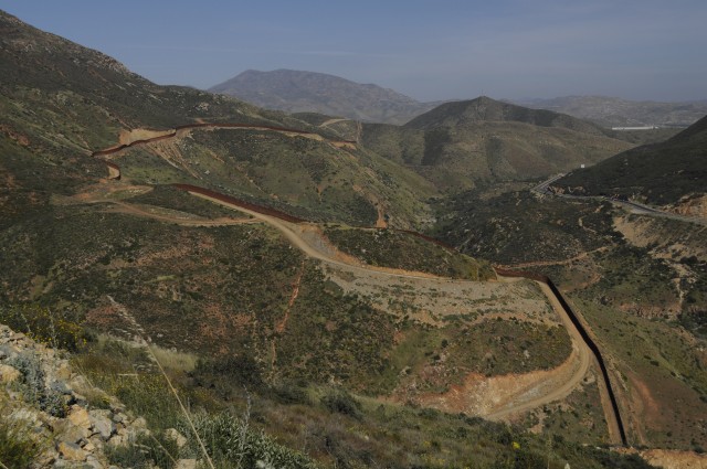
Border Wall: The walls referred to as tactical infrastructure by the border patrol include 3.6 miles of wall starting at Puebla Tree and ending at Boundary Monument 250, and over 5.2 miles of access road. The majority of the primary pedestrian wall will be within the Roosevelt Reservation, but 1300 feet will extend into the protected areas of Otay Mountain Wilderness. The wall is 15-18 feet high, and comprised of concrete filled steel tubes, spaced to “prevent even the passage of small animals.” Nearly half of the access road will be within wilderness boundaries.

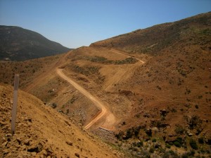
A photo from May 2008 shows stripping of essential topsoil resulting in permanent destruction to the habitat
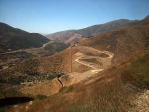
Environmental Impacts: The rugged terrain required the blasting and removal of 530,000 cubic yards of rock, and extensive grading and leveling in order to build the wall and the accompanying road. To facilitate construction, Road 250, which runs perhaps three miles from the Marron Valley Preserve to Boundary Monument 250, was re-graded and re-opened after being washed out some 20 years ago.
According to the draft EIS prepared prior to the waiver of law was invoked, construction of the border wall will have long-term, adverse impacts on plant, animal, and hydrological recourses of the area.
The grading and construction of roads in the Otay Mountain Wilderness resulted in the removal of the valuable layers of topsoil–delicate, intertwined root systems that have taken tens of thousands of years to develop and that are essential to protect the the dry chaparral habitat from erosion.
Otay Mountain Wilderness represents a unique ecosystem, home to twenty sensitive plant and animal species, including the endangered quino checkerspot butterfly, the only known stand of Tecate cypress, as well as the only known population of the Mexican flannel bush. Sediment threatens to overwhelm the Tijuana River watershed, which provides drinking water to the city of Tijuana and is home to the endangered arroyo toad.
Alternatives: The 2006 Secure Fence Act stated, “If the topography of a specific area has an elevation grade that exceeds 10 percent, the Secretary may use other means to secure such area, including the use of surveillance and barrier tools.” Otay Mountain Wilderness has gradients exceeding 40% . As Richard Kite, San Diego Sector spokesman for the Border Patrol stated, “It’s such harsh terrain it’s difficult to walk, let alone drive. There’s no reason to disrupt the land when the land itself is a physical barrier.” Indeed, the fencing may increase the burden on individual agents. With the steep terrain of the mountain itself acting as a barrier, migrants were forced to use three canyons (Mine, Buttewig and Copper) to journey North. They were easily tracked, and apprehended as they exited. They will now be dispersed to points further east.


