Tecate Peak
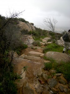
Hiking around Tecate Peak, you feel a sense of the sacred. The wisdom of the ancestors seems to radiate from high, sheer rock walls and enormous boulders that spread off to the horizon.
The idea of building a low wall to carve through this vast wilderness seems completely pointless as your eyes survey the landscape. If you can hike through this mountainous terrain, you can certainly climb over a little fence.
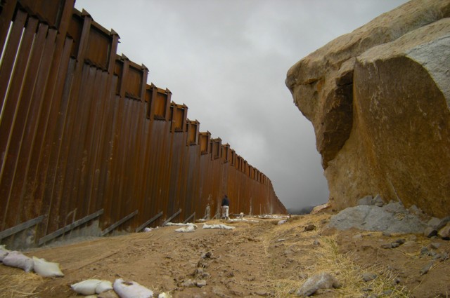
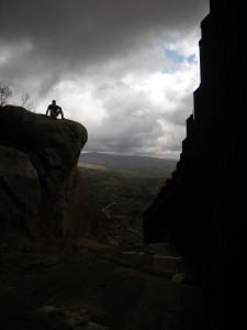
I feel much more ambivalence when confronted with the reality of the border wall at Tecate Peak. The wall carves a deep scar through this sacred landscape which is visible from miles back.
Soaring signal rocks, visible against the turbulent sky are sliced and broken to make way for the iron bars of the border wall.
Yet, a closer look reveals the vulnerabilities of this icon of Fortress America. Turns out that Mother Earth isn’t so easy to control.
The latest border wall to grace the slopes of Tecate Peak was built during the summer and fall of 2008. The December 2007 Environmental Impact Statement for border infrastructure in Otay Mountain Wilderness identifies a section to be built at Tecate Peak of an 8th of the mile in length along with a section of border wall in Otay Mountain Wilderness.
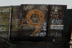
The new border wall begins where the older 1996 border wall ends, just west of the border town of Tecate. Here, graffiti artists celebrate “The End” of the old wall.
The wall then winds up an extremely steep peak for nearly one mile, then stops abruptly just higher up the mountain.
Tecate Peak is known as Kuuchamaa, a sacred mountain to the local Kumeyaay people. Only those who had been properly initiated as shamaans could step onto the mountain, and in the 60s & 70s, herbalists and curers would not climb the sacred slopes. Those elders who had heard stories in their youth about ceremonies on the mountain knew that it was forbidden to speak of the mountain and the ceremonies. Improper use of the mountain or speaking ill of the spirit of the mountain was forbidden on fear of death (Shipek, Florence 1985).
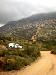 Thus, to see a wall winding its way up into the ethereal mist of Tecate Peak evokes sadness, and fear. Just north of the border crossing at Tecate, you can find the dirt road that takes you west to the bottom of the mountain. Off the highway, there’s a cluster of businesses, parking lots and dirt roads, and when you weave your way through this, you will come out on the west side. Look up, and the mountain rises into view.
Access to the mountain was limited in modern times by BLM restrictions. The Bureau of Land Management gated the road to the mountain’s peak, to protect the delicate chaparral from wildfires. Today the road is open to hikers, a 9-mile hike from the bottom to the top of the mountain where a fire-lookout station was once located and TV relay tower now stands.
A hike up the mountain alongside the border fence reveals the internal vulnerabilities of this seemingly solid wall.
As we hiked up the 8th of a mile stretch on March 22, 2009, we saw a massive brown iron wall marching through tiny groves of trees and massive outcroppings of granite boulders. I laughed as I noted one tree that appeared suddenly to find itself behind bars.
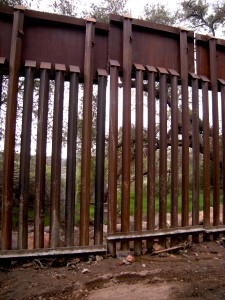
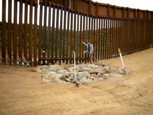
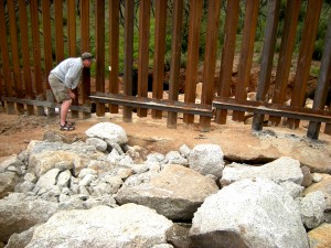
Yet, the 4-5 foot deep cement-filled trenches in which the panels of the border wall are lodged are not invulnerable to the natural flows of rain and runoff. Another quarter mile above, we came upon the evidence of a big washout of two entire fence panels. The winter rains of December to March had taken their toll on DHS’s fortress wall.
Upon inspecting the site, what appears to have happened is that the natural water flow undermined the soil beneath the foundation of the fence, and beneath the trench itself.
The fence line runs east-west, perpendicu
It seemed that the panel was quite recently repaired–indeed, the fence was built in October, and already, less than 6 months later, massive sections are washed out already.
The panels had been reset in concrete, and the huge sinkhole had been filled in with heavy rock, just to cover the holes. The natural wash of water runoff was clearly visible through the landscape.
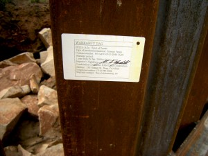
A warranty tag gestured to the frustration the contractors must have felt, having to construct a wall in these steep mountain slopes.
The warranty fills in the details of our story for us: RMA Land Construction, the contractor on this leg of the project, agreed to guarantee the fence for only one year. The date on the warranty, January 29, 2009, suggests that the fence must have washed out AND been replaced by the end of January, a mere 2-3 months after construction.
A little ways up the mountain we came across yet another washout. And as we climbed upward, at times on our hands and knees, we came to see what it means to carve a trench straight across a natural pathway for the winter rains.
Deep ruts down the middle of the border patrol access road threatened to engulf us. Sad attempts to sandbag the roads were evident, thin worms of sandbag were strewn across dirt.

